
A few weeks ago, while on the road, I received an SMS with the location of a meeting place in longitude and latitude.
Since the GPS wasn’t plugged in, I decided to try finding the location with my phone.
I first tried Apple’s Maps application:
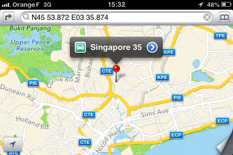
Since I thought it unlikely that my destination by car would turn out to be in Singapore, I tried OpenMaps:
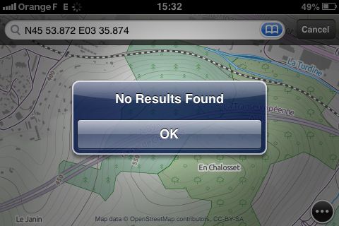
Having struck out there as well, I was happy to have downloaded Google Maps, which immediately showed me the correct destination:
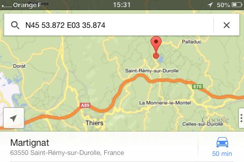
I was left wondering why I always try Maps first.

I’m wrong person to ask. Only have maps on iPhone. I’m really afraid to go further than four blocks from home.